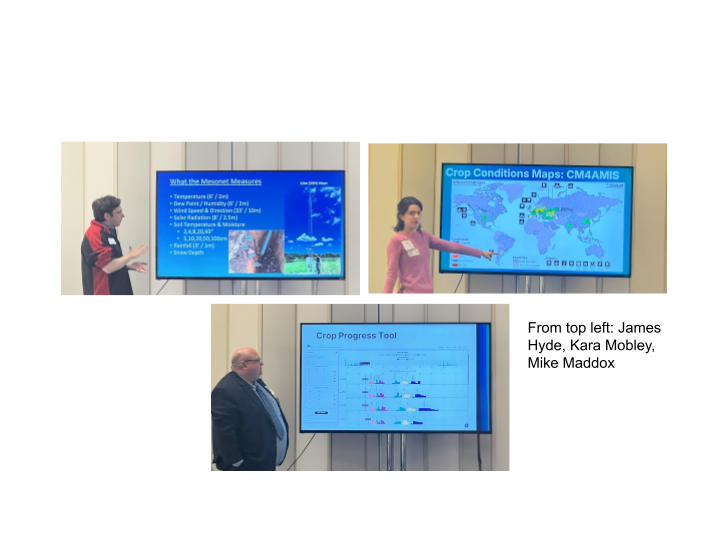
Last month, the Climate Resilience Network attended the LEAD Maryland Workshop, an event organized by the LEAD Maryland Foundation, which is run through University of Maryland Extension, to discuss how satellite data and artificial intelligence/machine learning augment the Climate Resilience Network’s (CRN) agricultural monitoring initiatives and the NASA Acres and Harvest programs. CRN’s agricultural monitoring data visualizes the potential effects of climate change on agricultural production in Maryland, impacts of agriculture on the environment, and other climate-related issues. LEAD workshop speakers delved into how satellite data and artificial intelligence (AI) can “fill in the gaps” of various facets of the agricultural industry, including weather and climate monitoring, risk management, and crop monitoring. NASA Acres and NASA Harvest are NASA’s consortia focused on domestic and global agriculture, respectively. Both are led by the University of Maryland.
Below are five takeaways on the potential of satellite data and AI in the advancement of agricultural monitoring and practices.
1. There are many remote sensing/earth observation tools available to farmers, but most don’t know about them.
Powerful agricultural monitoring tools that visualize data regarding crop health, production, weather and climate, and many other factors in agricultural success have been developed in the past decade. However, few farmers in Maryland are aware of NASA’s agricultural initiatives or capabilities. Additionally, the Climate Resilience Network is a new project (started in 2023) as part of the University of Maryland’s Grand Challenges Initiative that is just gaining traction. LEAD Maryland trains its participants on educating farmers and other agricultural stakeholders about the relationships between farming and climate and best practices for increasing resilience and sustainability. This education could also include the following tools that empower producers and decision makers by providing in-season data of crop conditions and production from the hyper-local level, like the exact latitude and longitude on a farm, to the global level.
NASA developed the Global Agriculture Monitoring System (GLAM) to monitor farms in countries that produce wheat, maize, rice, and soybeans. It is a web based platform that enables near-real-time visualization and analysis of global croplands. Data can also be freely downloaded by specialists and non-specialists. GLAM aggregates and visualizes data like soil moisture, precipitation, changes in water bodies, and the “greenness,” or health of crops. GEOGLAM and NASA Harvest developed the Agrometeorological (AGMET) Earth Observations Indicators dashboard to provide a simple way to visualize and monitor climate, environmental, and vegetative variables that impact agricultural outcomes. The indicators were developed by agricultural stakeholders under the GEOGLAM Crop Monitor Initiative with the main goal of identifying potential cropping concerns before a food shortage occurs. The AGMET Earth Observation Indicators keep track of crop production relative to previous years in a cost-effective and timely manner, getting updated every 7-12 days. Harvest also created an iOS application called HarvestNow that allows users to collect field data offline. With the app, analysts can easily collect ground truth data around the world which is used to combat food insecurity.
University of Maryland and the Climate Resilience Network also developed several dashboard tools within the past couple of years. The Dashboard for Agricultural Water Use and Nutrient Management (DAWN), launched in 2020, was designed to support corn producers in Corn Belt states (Indiana, Illinois, Iowa, Missouri, Nebraska, and Kansas) in seasonal planning with more accurate field-level forecasts, ranging from two weeks to six months. The Maryland Mesonet launched in 2022 with the goal to build and operate a network of rapid-sampling weather monitoring and data collection systems across Maryland to advance emergency preparedness, accuracy of regional weather forecasts, and expedite disaster assessment and recovery. Near real-time observations are automatically shared with the National Weather Service and made available to emergency managers and Maryland citizens for free. The Maryland Agriculture Climate Impact Dashboard launched in early 2025 to monitor local food production. This tool is publicly accessible and was developed to assist producers, policymakers, and other stakeholders identify and direct resources into Maryland’s most vulnerable farmland. The dashboard brings together datasets from NASA Earth Observation and other satellite products with new analysis by the Climate Resilience Network team and presents it in a way that is accessible and interpretable for farmers, policymakers, and the general public.
These are just a few of the agriculture monitoring tools in operation and more are on the way, especially as the agricultural industry works to incorporate AI and machine learning (ML) in its processes to improve monitoring worldwide. All of the tools outlined here are free of charge and available to the public.
2. Improvement of agricultural monitoring tools and techniques depends on farmers’ willingness to collaborate and share data with researchers. Relationships are key.
As previously stated, most farmers are not aware of NASA’s agricultural initiatives, although NASA Acres and Harvest are working to change that. Acres and Harvest heavily depend on the direct input of producers to develop and update their dashboards. Farms are incredibly labor and time intensive; most farmers wouldn’t have the time or inclination to partner or share data with researchers without knowing how it would benefit their business. However, this doesn’t necessarily mean that there is no interest.
Farmers, perhaps more than most, see how changing weather patterns and the health of soil or water impacts their crops and livestock. However, many do not engage with the implication that their business could be harming the surrounding ecosystems. To build true partnerships with producers, researchers must find common ground with them and show how changing or incorporating practices could benefit their land, and ultimately their bottom-line. Another critical aspect of building trust is transparency. Researchers must be clear about their goals and methodology and be able to answer questions about how farmers’ data will be used, who owns the data once it is shared, how farmers could be compensated, and minimizing unintended consequences.
3. AI can augment resources/processes already available.
AI in the hands of people as passionate and talented as the speakers at the workshop has the potential to revolutionize agriculture. AI has already proven to be useful in processing the massive and growing volume of earth observation data, most of which was inaccessible just a decade ago. Machine learning (ML) helps extract meaningful insights from earth observation and satellite data, enabling rapid, informed decisions in agriculture. Geo-foundation models, pretrained on global satellite data, provide versatile representations for tasks like crop type mapping, yield estimation, land cover analysis, and field boundary detection.
The Arizona State University Kerner Lab and Harvest machine learning team are developing advanced methods and datasets to bridge the gap in machine learning for satellite remote sensing data. The purpose of this work is to extract valuable insights from satellite data as efficiently as possible to support rapid and early responses for agricultural decision makers. The team collaborates with stakeholders to deploy innovations in operational applications that address real needs in the agricultural industry.
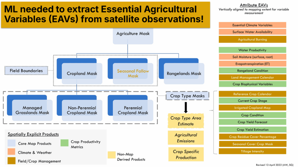
Essential Agricultural Variables outline the key variables that can be derived from satellite observations
4. Accurate agricultural data is vital for our economy, food supply, and national security.
Global agricultural monitoring requires the cooperation of many countries and their governments, which, in turn, requires a certain level of trust between partners. Accurate agricultural data allows all stakeholders to make critical decisions with true information. Before earth observation, it was very easy to make critical errors like the United States did in the early 1970s, which made way for the Great Grain Robbery.
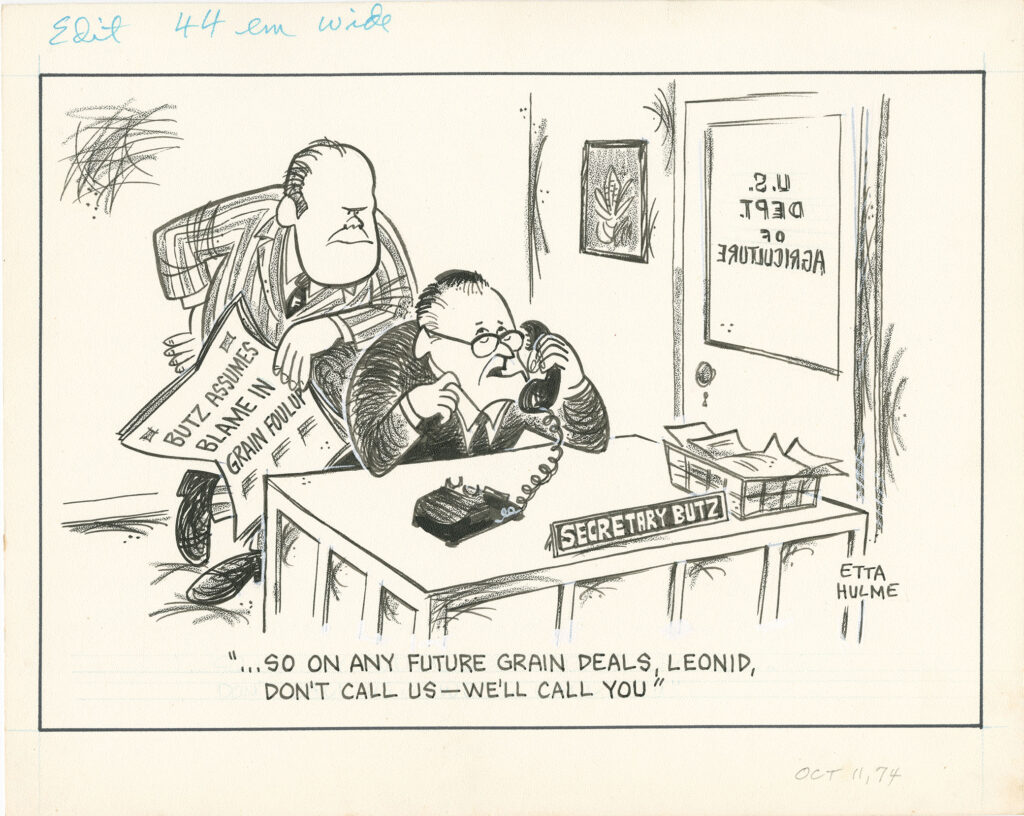
1974 cartoon by Etta Hulme. University of Texas at Arlington Libraries, Special Collections.
In the summer of 1972, various countries in Europe experienced a drought, which triggered a widespread wheat shortage. In response to its own shortage of grain, the Soviet Union bought up tons of foreign wheat, including 10 million tons of wheat from the United States government, which, “did not have a big picture view of agriculture output worldwide,” and as a result, failed to understand the significance of the global crop failures and grain shortage. Before we knew it, the U.S. spent $300 million ($2.3 billion in 2025) in public funds and lost the same amount in potential revenue, which caused the cost of domestic wheat to sharply increase. The U.S. also unwittingly awarded subsidies to the USSR, which greatly reduced the purchase price for the Soviets.
This event illustrated the importance of access to accurate and timely global agricultural data and directly led to the Large Area Crop Inventory Experiment of 1974. The Agricultural Market Information System (AMIS) and Group on Earth Observation Global Agricultural Geo-monitoring Initiative (GEOGLAM) were also developed in response to similar global food price increases in the early 2000s. Earth observation data promotes market stability by producing accurate and timely agricultural data regarding crop health, crop production, environmental and weather disruptions, socioeconomic risk factors, and import/export logistics. It allows for preemptive planning, which is critical for effective prevention and mitigation of crop failures.
5. Agriculture monitoring and improvement is an interdisciplinary endeavor.
Advances in agricultural monitoring would not be possible without the cooperation of people from many different backgrounds of expertise, nationalities, and perspectives. Speakers at the LEAD Maryland workshop represented GIS/remote sensing, computer science, economics, information technology, hydrology, and atmospheric sciences. Their work depends on the contributions of environmental scientists, meteorologists, animal and plant scientists, natural resource managers, and others. Of course, some of the most important partners are farmers, as they are typically experts about their land, crops, livestock, and communities. Without their input, researchers would not be able to directly address the issues that most impact their farms.
The Climate Resilience Network is a collaboration between University of Maryland Departments: Atmospheric and Oceanic sciences, Geographical sciences, Geology, and the Marine Estuarine Environmental Sciences graduate program, and is supported by UMD’s Grand Challenges Institutional Grants. Initiated in 2023, the goal of Climate Resilience Network is to unify the expertise of researchers with the immediate needs of Maryland’s decision makers to address coastal flooding, air quality, and other challenges. Based in a research-to-impact philosophy, CRN develops innovative solutions that meaningfully support our region in addressing societal impacts of climate change.